Canada Watersheds Laminated Map (42"x38")
$35
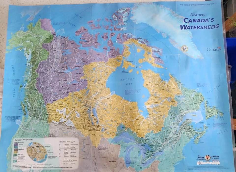
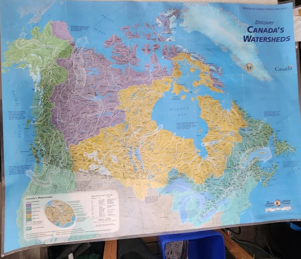
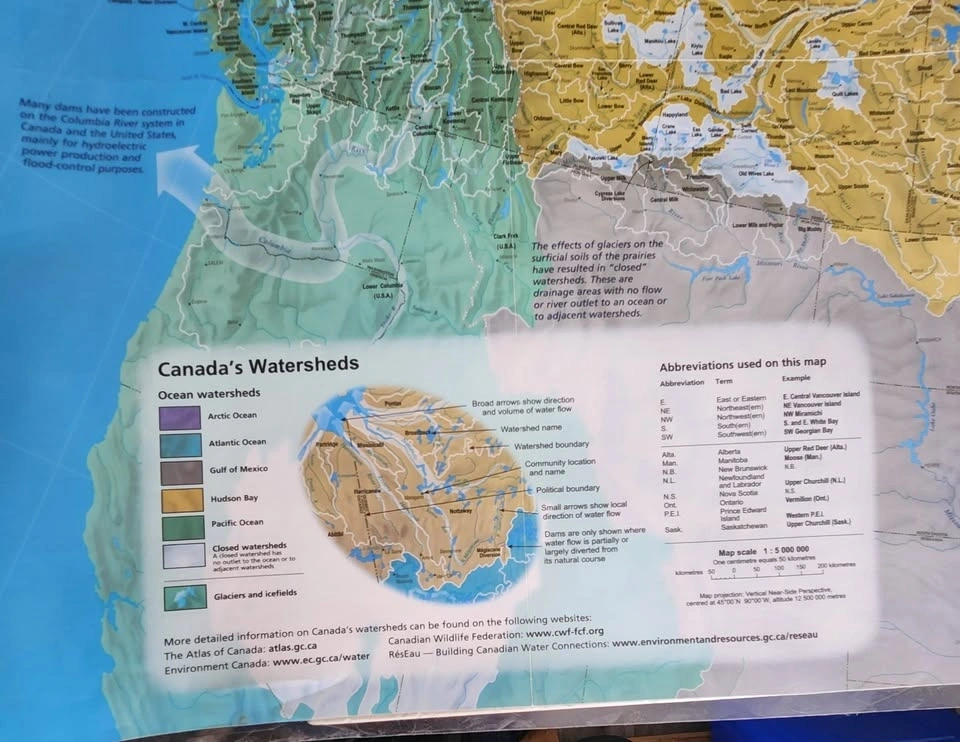
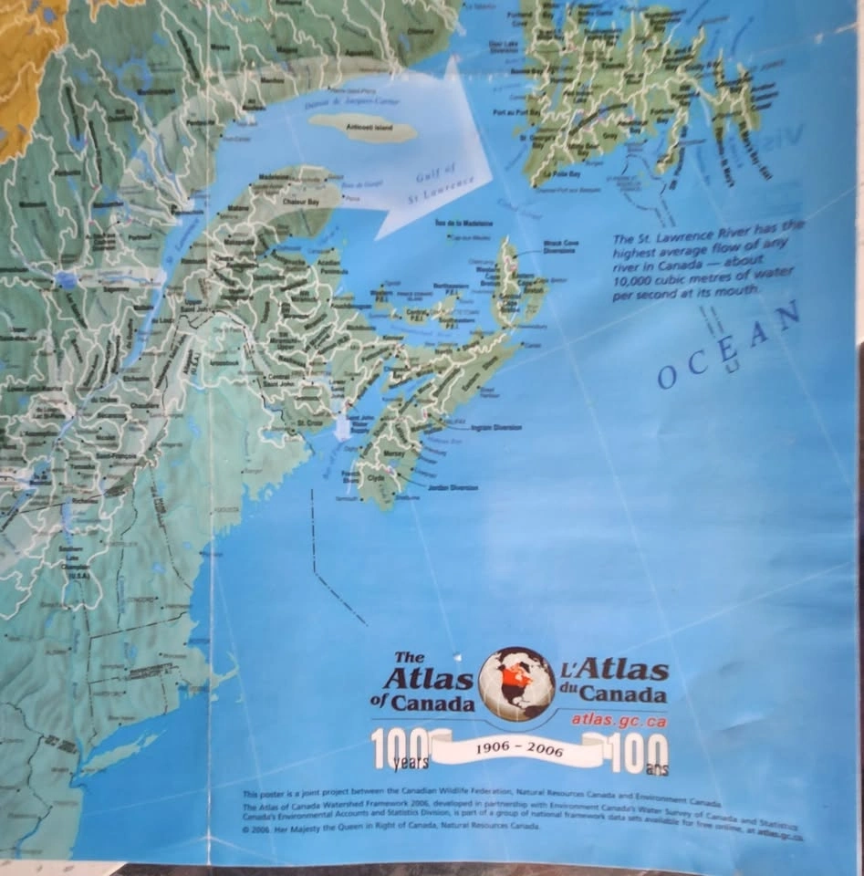
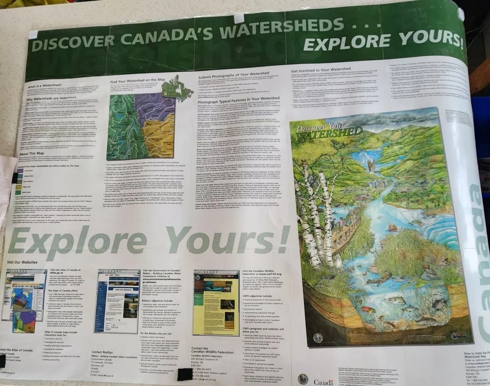
This map shows the major ocean watersheds of Canada, illustrating where all surface water across the country eventually drains. Produced by Natural Resources Canada and the Canadian Wildlife Federation, it depicts a hierarchy of 594 connected watersheds grouped into five massive ocean-draining landscapes. The map uses distinct colors to identify the five primary ocean drainage areas: Yellow for the Hudson Bay Watershed, Purple/Orange for the Arctic Ocean Watershed, Green for the Pacific Ocean Watershed, Light Blue/Cyan for the Atlantic Ocean Watershed, and Small Tan/Yellow for the Gulf of Mexico Watershed. The lower-left corner contains a detailed legend explaining these color codes and showing the hierarchy of sub-watersheds. These boundaries act as "drainage divides." Map details: Scale typically 1:4,000,000. Located in St. Catharines near Western Hill. Door/porch pick up and cash only.
WHERE TO MEET
SELLER

Harold
Western Hill
 10
100 reviews
0 chats0 favorites5 views